Sterkhorn (Mount Memory) Day Hike
Drakensberg Hikes
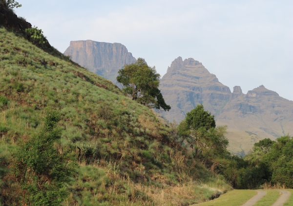
The Monk's Cowl Nature Reserve with its breathtaking vistas of sweeping grasslands on the lower reaches, to magnificent towering cliffs and waterfalls cascading for hundreds of metres makes this an area of the Maloti-Drakensberg Park worth visiting.
For very fit and experienced hikers / trail runners Sterkhorn (Mount Memory) can be reached on a day hike and at the top you will find the M.O.T.H memory cross.
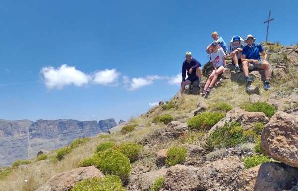
Treverton Pupils and Teachers at the top of Sterkhorn (Image Credit: Travers Pellew)
On Sunday 3 Treverton pupils and 2 teachers took on this day hike which will contribute towards the outdoor pursuits awards the pupils can earn. Monks Cowl was reached at 6.15am and the hike started at 6.30am. The pace was fast and Breakfast Stream was reached an hour later, Blind Man's Corner was passed soon thereafter and a short stop to collect some water at the base of Sterkhorn before commencing the final climb up, only 2 hours had passed!
Two hours later and everyone was at the summit (2 973m), a fantastic achievement to be very proud of.
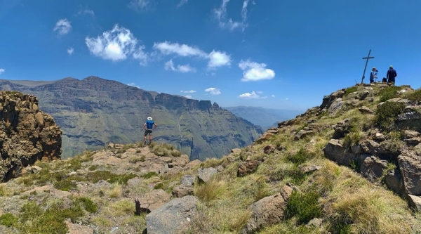
Stunning views from the top of Sterkhorn (Image Credit: Travers Pellew)
This hike is not for everyone. The hike to the top of Sterkhorn is 8.3km's with a total elevation gain of just under 1.5km's and the return via the same route making it a very difficult 16.6km day hike.
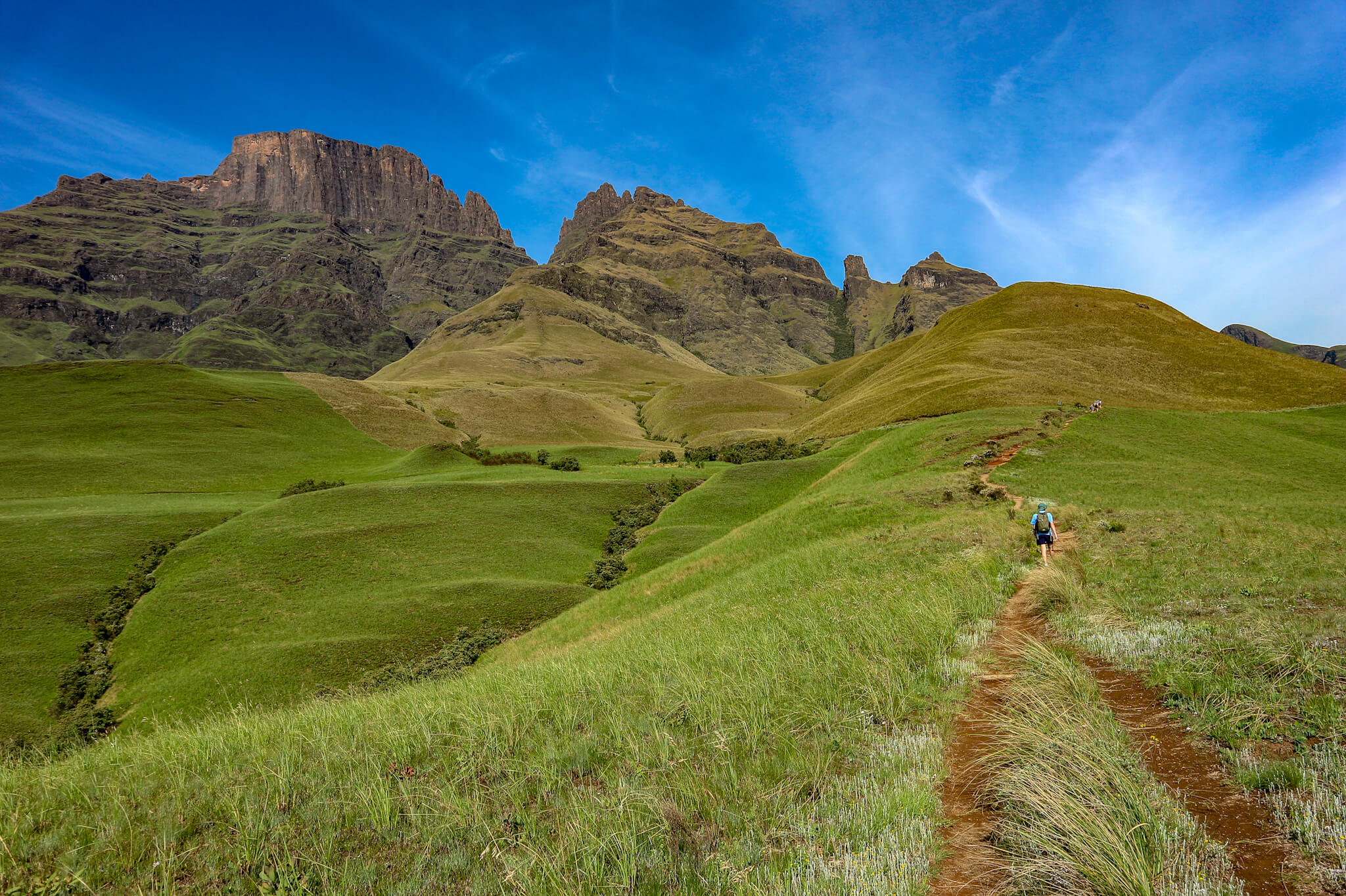
Monks Cowl Nature Reserve - the start
The start of the hike is at the Monks Cowl Nature Reserve offices where you sign the mountain register. Your hike starts on the trail heading to Crystal Falls, the Sphinx and Breakfast Stream. By the time you reach breakfast stream you would have already climbed 550m in elevation over 3.4km's. A good spot to refill your water bottles and have a short rest.
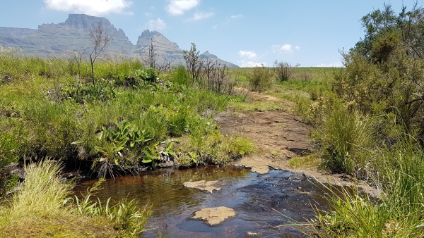
Breakfast Stream
Next you head towards Blind Man's Corner, 2.5km's and 120m elevation gain, this section is the flattest of the whole route and is an easy stretch.
At Blind Man's Corner you turn left onto the contour path heading towards Injisuthi. You hike 400m along this path till you find a small path leading up towards Sterkhorn. If lucky you may find some water to refill here, else the water you got back at Breakfast Stream will have been the last opportunity.
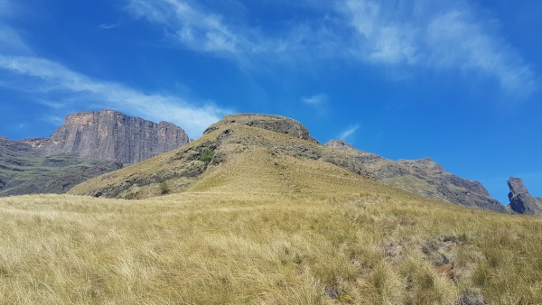
The Sterkhorn climb starts in earnest.
Follow the path up to Sterkhorn and your hike now begins in earnest, you have 2.1km's and 720m elevation to go. There are some exposed sections along the hike up where due care needs to be taken and finally some rock scrambling to the top.
| distance | duration | avg. speed | trackpoints | trackpt. distance |
|---|---|---|---|---|
| 8.1 km | n/a | n/a km/h | 859 | 9.4 m |
| altitude range | lowest point | highest point | uphill | downhill |
|---|---|---|---|---|
| 1389 m | 1489 m | 2878 m | 1431 m | 45 m |

Additional info about the hike can be found here.