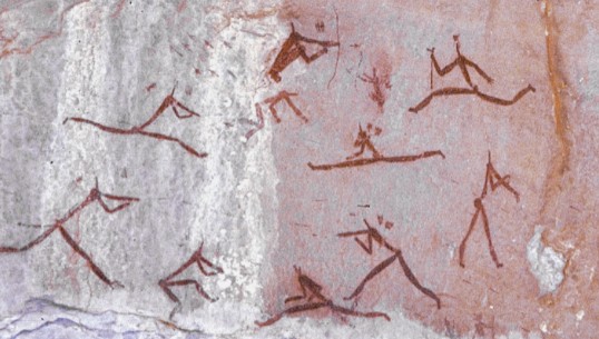
Battle Cave Hike


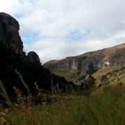

From Injisuthi Camp follow the route towards Fergy's Cave and then take the right fork along the Injisuthi River approximately 4kms from the start and about 1km before Fergy's Cave.
Total distance to the cave is 5.7km and an climb of only 258m.
The cave is fenced so cannot be accessed without a guide. Contact: 036 431 9000 or
Listing Details
Area
Location (Degrees)
29°09'24.0"S, 29°24'56.4"E
Location (Decimal)
-29.156667, 29.415667
Cave Name
Type of Hike
Day Hike
Hike Grade
Total Hike Distance (Km's)
11.4
Hike Duration (return)
2.5
Total Hike Duration (Hrs)
5.0
Explore
Bushman Paintings, Caves
Altitude
1,742
Tags
Tracks
GPS Track Details
| Track length: | 5.74 km |
| Total ascent: | 298 m |
| Total descent: | 80 m |
Map
Reviews (0)