

About Drakensberg Hikes
Drakensberg Hikes is an independent community portal providing verified trail reports, sleeping cave logs, GPX tracks, and accommodation directories for the Maloti-Drakensberg World Heritage Site.
For many years Didima Nature Reserve has been my personal favourite region of the Drakensberg. With the Cathedral Peak ridge, the Column and the Pyramid, the Organ Pipes and the Didima Cutback - it is truly a special area. I could list many reasons why Didima is my first choice in terms of beauty, but one small area stands head and shoulders above the rest - the cutback between Cockade Peak and the Elephant.
Having made three different trips that included Cockade Pass, its northern neighbour continued to elude me. Seeing as it stood as the only pass marked on the Geoseries Maps that I had not completed; I knew I needed to head out and bag the notorious Xeni Pass.
Xeni Pass is definitely not suitable for everyone, there are a few scrambles where you have to be careful not to bring a lot of rock down on yourself.

Marco capturing the sunrise from Neptune Hill. Mlambonja Buttress and Pass in the background.
Marco and I left Cathedral Peak Hotel at 5:30am. After briefly having a bit of difficulty finding the correct road to walk on, we found ourselves slogging up the route to Neptune Pools in the dark. We reached the point where the trail starts winding up the hill around sunrise.

We continued up the hill, reaching the contour path around 7:15.

The Pyramid and the Column with Cleft Peak in the background.
We stopped for a break on the contour path. Weather was perfect, but there was a lot of smoke in the air due to fires throughout the region.
As we completed the contour path section and dropped to the Xeni River, we were surprised to see some snow left on the vegetation as low as 2000m.

The approach to Cockade and Xeni Pass is well known for being overgrown, although I am not entirely sure why - any number of pass approaches that are considerably worse come to mind.

Xeni Pass as seen from the turn off from the contour path
The riverbed was very iced up, which made the approach a bit trickier than normal.


Marco on one of the waterfall scrambles on the approach to the pass
After reaching the Xeni/Cockade split, it was new ground for both of us. The pass starts with a series of waterfalls which are bypassed by a steep grass side slope.

Marco scrambling up a steep grass slope

Looking up the pass
Eventually an easy traverse back into the gully is reached, and you can return into the gully.

Looking down the pass from the traverse into the gully
The gully includes various scrambles - some of which are fairly loose.

Marco deciding the best route up this obstacle. We bypassed it to the left in the end.

Marco scrambling up a grassy bypass around an obstacle

The gradient of the pass is definitely rather substantial!
As you get higher, the views become more and more impressive. The cliffs of Elephant and Cockade are visible in the distance, while the mighty Leopard towers above you.

Cockade Peak from Xeni Pass
Higher up, the gully narrows, making for some dramatic views.

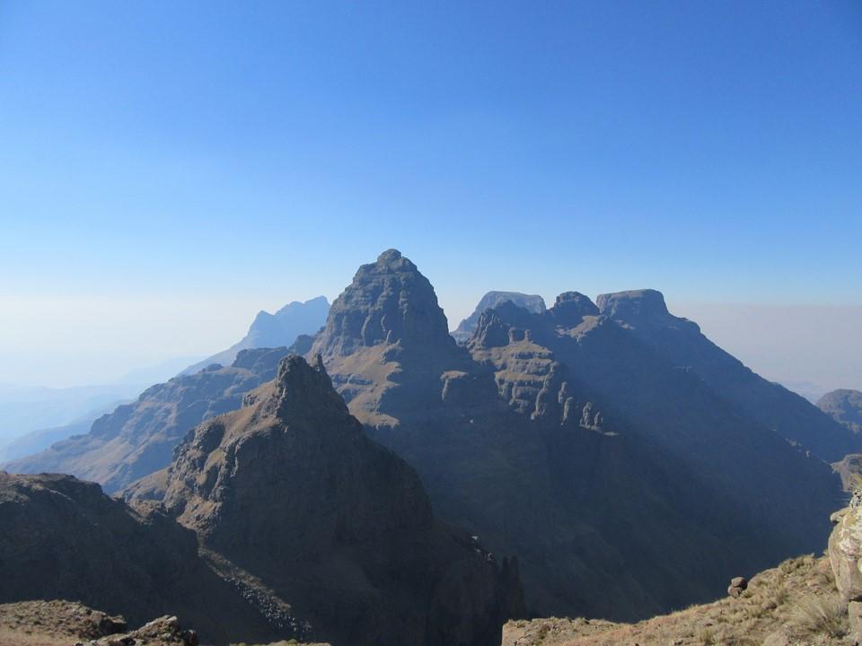
Pyramid and Column come into view behind Cockade as you get higher.


Almost at the famous worm hole.

The famous chockstone/wormhole. It is easily bypassed by walking under, around inside and then over the top.

Pyramid and Column as seen from near the top of the pass
From the wormhole the gully gets considerably easier and is over before you know it. We took a summit selfie before dropping down to the river for some lunch. We reached the river by 1:30, so roughly 7 hours from hotel to summit.


Marco with a shepherd that came to chat to us during lunch
We had made good time up, but may have overcooked it a bit - the walk to the top of the Bell Traverse took longer than expected.
Top of the Bell Traverse

Twins Cave

The Mitre

The exposed corner to the Twins/Mitre saddle
The route started off about as simply as normal.The smoke in the valleys below obscured a lot of the view, but it was still its normal dramatic self. There had been a rock fall near the infamous ledge on the east slopes of the Mitre, which made the step across considerably more difficult.

Looking towards Easter Cave Peak

The Outer and Inner Horn

A dassie on the slopes of Outer Horn
Once the trail crossed over to the Bell, there was a significant amount of ice. Seeing as we had carried them all this way, we both put our crampons on.

Ice on the trail

The Bell

Marco on the iced up sketchy traverse near Bell Cave.

Sunset from Buggers Gully
Bell Traverse took considerably longer than planned, and we had our headlamps on shortly before Orange Peel Gap.
We were back at the hotel by 8:30, meaning that we took 15 hours to complete our 31km hike. Not express pace by any means, but also notably not the easiest route around.
Overall I rate Xeni Pass as one of the toughest passes I have done, but also one of the most worthwhile. I must stress that it should only be attempted by experienced hikers who are comfortable with heights and scrambling.
Also a big thanks to the staff of Albert's Bar at Cathedral Peak Hotel for arranging food for us after the hike!
⚠️ Mountain Safety Notice
Weather conditions in the Drakensberg escarpment can change within minutes. Always register your group in the official Ezemvelo Mountain Rescue Register before starting any overnight trail, carry gear for extreme cold/rain, and ensure you have verified offline GPS tracks.
Download Rescue Form (PDF)More Mountain Stories & Route Reports

Monks Cowl to Sterkspruit Falls

The Mitre

Travel Insurance for hiking & trekking

A family-friendly guide to hiking in the Drakensberg

Kamberg to Game Pass Shelter
